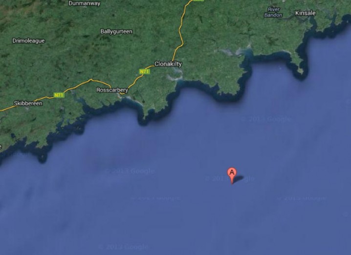
A map pinpoints the epicentre of the earthquake that occurred off the coast of Co Cork yesterday morning
Seismic stations in Dublin, Wexford, Valentia, Co Kerry, and as far away as Wales picked up a 2.6-magnitude earthquake off the coast of Co Cork yesterday morning.
The Irish National Seismic Network (INSN) confirmed the earthquake occurred at 7.57am in the Celtic Sea, some 18 kilometres south of Ballymacshoneen on the Seven Heads Peninsula in West Cork.
The INSN added the earthquake is the first known seismic event of its kind to be recorded in the region since record-keeping of such events began in 1978.
Tom Blake, INSN director from Dublin Institute for Advanced Studies, said the earthquake is noteworthy because of its magnitude and and the fact it occurred in a region that has not previously shown any seismic activity since record-keeping began.
“We have received felt reports from Courtmacsherry and Timoleague, which are located 25 and 27 kilometres respectively away from the epicentre,” Blake said of yesterday’s earthquake.
The strongest earthquake recorded in Ireland most recently took place on 6 June 2012, when a 4.0-magnitude earthquake occurred 60 kilometres west of Aughleam, Belmullet, Co Mayo.