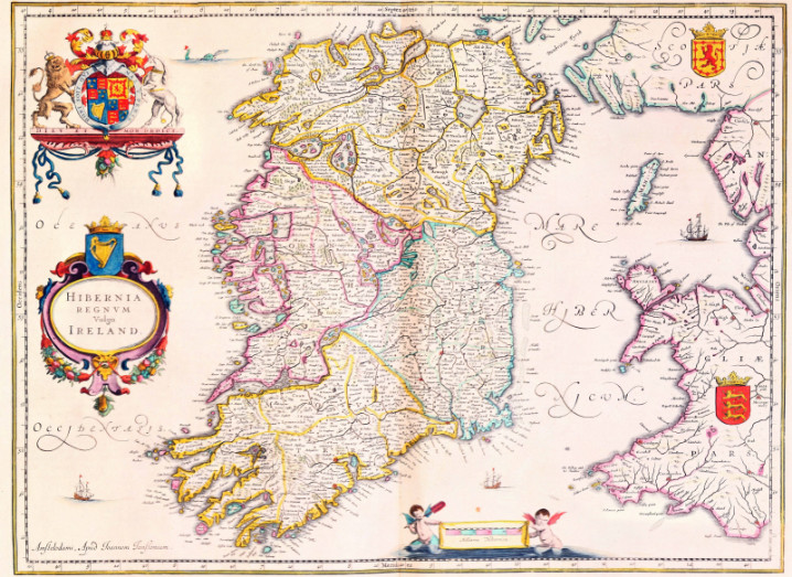
The Jansson map of Ireland
Trinity College Dublin (TCD) has launched The Fagel Project, an online resource of 10,000 significant maps dating from before the 1800s.
The free website is designed to replicate the design of one of perhaps the greatest map projects of all time, Google Maps. When you enter the website and click on a map, the user will be able to examine, zoom and scroll around some incredibly illustrated battle plans, urban streetscapes and architectural drawings.
The Google interface will include a ‘time’ feature which will allow users to drill down through maps of the same area drawn up at different periods to explore how the area developed. The website will also incorporate a number of novel visualisation tools, including 3D modelling of selected battle plans and urban streetscapes.
The project is part of an ambitious new digital humanities project being undertaken by the departments of history, geography and computer science at TCD.
An invaluable resource
The collection contains maps from all parts of the world, with a particular emphasis on Europe, regions where the Dutch had trading or colonial interests, or areas of recent discovery. It includes more than 900 detailed urban street plans, several hundred battle plans showing all major conflicts in Europe from 1650 to 1800, as well as sea and celestial atlases.
Project leader Dr Micheál Ó Siochrú, associate professor in modern history at TCD, hopes the project will help those not just in Ireland, but the world, chart the progress of the history of where they come from and how it has changed.
“The creation of the Fagel map website gives these glorious treasures of Trinity Library a new lease of life and will provide an invaluable resource for all who wish to understand the development of European identities and of Europe’s relationships with the wider world.”
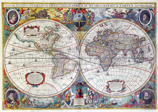
The world map from Jannson’s Atlas Contractus, Amsterdam, 1665. Image via The Board of Trinity College Dublin.
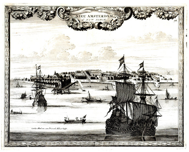
An engraving by Carolus Allard from Principal Cities of the World, Amsterdam, 1670. Image via The Board of Trinity College Dublin