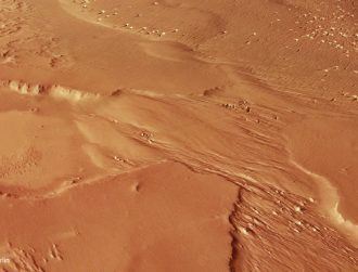
An oblique perspective view of the southernmost portion of Phlegra Montes on Mars using data from the stereo channels of the High Resolution Stereo Camera on the ESA's Mars Express. Image via ESA/DLR/FU Berlin, CC BY-SA 3.0 IGO
New photos from US space agency NASA’s Mars Reconnaissance Orbiter hint at the existence of enormous glaciers 700m years ago that may still linger under the planet’s surface.
The images the spacecraft captured show a series of isolated hills, ridges and small basins spanning 1,400km across a region known as Phlegra Montes, believed to be between 3.65 and 3.91bn years old, according to the European Space Agency (ESA)’s detailed look at the photos.
The findings suggest ice could still exist underneath the surface of the ridge at a depth of as little as 20 metres.
The planet’s axis is believed to have varied considerably over millions of years, which would have contributed to conditions capable of supporting glaciers, but is now situated in the mid-latitudes of the red planet.
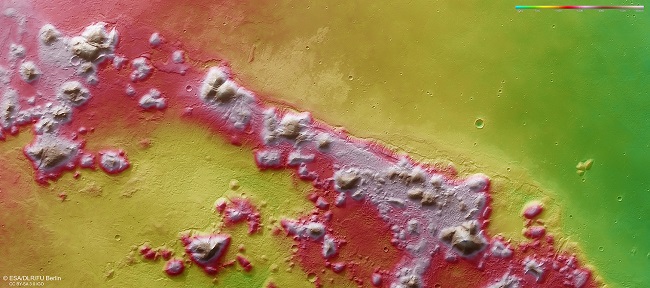
A colour-coded topographic view of the southernmost portion of Phlegra Montes based on a digital terrain model of the region, from which the topography of the landscape can be derived. White and red show the highest terrains, and green shows the lowest-lying terrain. Image via ESA/DLR/FU Berlin, CC BY-SA 3.0 IGO
The key giveaways to the former existence of glaciers is the rocky debris that surrounds many of the hills, as well as small valleys that cut through the hills that appear to show the glaciers may have once flowed into areas of lower elevation.
In stark contrast, the smooth, flat region just above the rocky hills would appear to indicate previous volcanic activity from the Hecates Tholus volcano in Elysium, some 450km to the west of the ridge.