Image: NASA
The NASA Landsat programme has been tracking environmental changes on Earth for more than 50 years – and Landsat 9 aims to do it better.
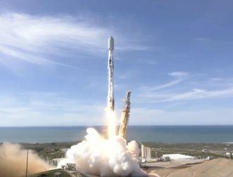
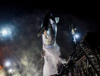
Arguably the most important satellite in space right now, NASA’s Landsat 9 powered on yesterday (4 October) after launching from California last week.
Part of the Landsat programme that has been imaging the Earth for almost 50 years, Landsat 9 is expected to image the entire Earth in 16 days and, together with Landsat 8, will track changes on the planet including those triggered by the climate crisis.
A week after launch, #Landsat 9 is powered on and getting ready to work! https://t.co/v8WjqbiPHX
— NASA Earth (@NASAEarth) October 4, 2021
The Landsat programme has been responsible for recording the growth of megacities and mapping changes in agricultural patterns, coastlines, forests, desserts and polar ice caps. It has also been used to study behavioural changes in wildlife and algal blooms in freshwater lakes.
In 2015, when work on Landsat 9 had started, NASA’s former associate administrator for science, John Grunsfeld, said: “Continuing the critical observations made by the Landsat satellites is important now and their value will only grow in the future, given the long-term environmental changes we are seeing on planet Earth.”
Landsat 9 launched from the Vandenberg Space Force Base in coastal California on 27 September on an Atlas rocket. While NASA was behind the building and launch of the satellite, it will be operated by the US Geological Survey.
According to NASA launch director Tim Dunn, Landsat 9 is accompanied by four small cubesats – or miniature satellites used in the lower orbit – to complement the satellite’s observations. Two will study solar wind and exoplanet atmospheres on behalf of NASA.
The other two are on undisclosed missions on behalf of the US Space Force, Dunn told reporters in a press conference before the launch, according to Space.com.
Expand ‘unparalleled record’ of Earth
NASA said that Landsat 9 “largely replicates” its predecessor Landsat 8 to reduce the build time and the “risk of a gap in operations”. Its life cycle cost is estimated to be close to $1bn – significantly higher than the cost of commercial alternatives.
“Those commercial companies allow us to do more, but they aren’t a replacement for the kinds of observations that we make with Landsat,” NASA Earth science director Dr Karen St Germain told BBC News.
“As an example, commercial systems, generally – they can observe more often, but they don’t observe all the wavelengths we need to do the work we do with Landsat,” she said.
Landsat 9 carries two instruments that have “moderate spatial resolution” and the ability to detect a higher range in intensity than Landsat 8, which was launched in 2013. It was designed by scientist Northrop Gruman who will support the satellite’s operation while it is in orbit.
“For nearly 50 years, Landsat satellites have documented Earth’s changing landscape,” Landsat programme executive Michael Egan said in the press conference. “Landsat 9 will improve and expand upon this unparalleled record of our home planet.”
Designed to last at least five years in orbit, Landsat 9 is intended to replace the ageing Landsat 7 which was launched more than 22 years ago.
Don’t miss out on the knowledge you need to succeed. Sign up for the Daily Brief, Silicon Republic’s digest of need-to-know sci-tech news.