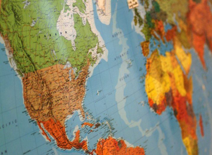
Globe close-up. Image: RHIMAGE/Shutterstock
A new world map projection created by a Japanese designer is unlike any that have come before it, and for his efforts, he has won a prestigious international design prize.
Despite its attempt to portray the world that we live in, the world map projection found on many school walls is actually loaded with political controversy and accusation of bias, and even racism.
This particular map with Europe at its centre is known as the Mercator projection, and it has been the cartographical standard for world maps since it was first introduced way back in 1569.

In the intervening times however, cartographers have complained that within this map, inaccuracies are abundant when it comes to the sizes of continents – with those in the northern half appearing larger than those in the south.
It wasn’t until 1974 with the Gall-Peters projection that any real contender for Mercator emerged, with its removal of perceived European bias and true representations of the sheer size of the continent of Africa.
But now a new competitor has entered the fray. Designed by Japanese artist and architect Hajime Narukawa, this looks like no world map we have seen before.
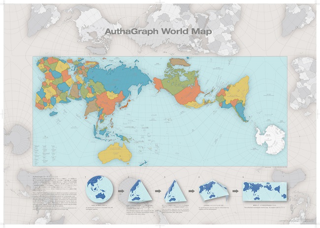
Image: Hajime Narukawa/AuthaGraph
Not completely accurate
Calling it AuthaGraph, the design is credited as being one of the most fairly proportioned maps created so far, resulting in him winning Japan’s biggest design award competition: the Good Design Award.
The striking map uses some advanced mathematics and geometry to fit in every single land mass as fairly and equally as possible, all within a rectangular map.
While looking like a stretched version of the Mercator projection, the obvious difference is that its centre line of longitude cuts right through Alaska and the Pacific Ocean.
“AuthaGraph faithfully represents all oceans [and] continents including the neglected Antarctica,” explained Narukawa in his overview of the design. “These fit within a rectangular frame with no interruptions. The map can be tessellated without visible seams.”
He goes on to say that AuthaGraph “provides an advanced precise perspective of our planet”, but that it does require a further step to increase a number of subdivision before it can be officially called an area-equal map.
In the meantime, map enthusiasts can order the AuthaGraph map online. When presented in rectangular form, it can be folded like origami to create an impressive 3D globe.
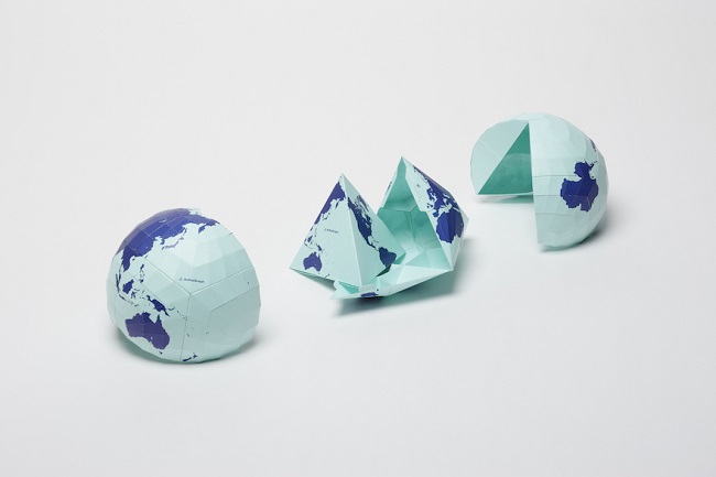
Image: Hajime Narukawa/AuthaGraph