Google has added a nifty new feature to its Google Maps service that lets owners of Android devices and DSLR cameras create their own 360-degree Street View panoramas of places they’ve been.
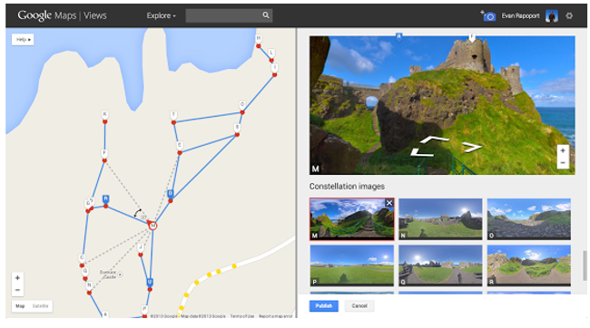
Users just select the photo spheres from their profile and use the Views tool to join the dots and create what Google calls “constellations.”
Once the spheres are connected and published people can navigate between them on Google Maps.
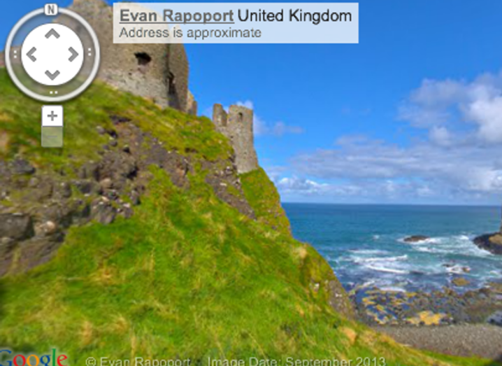
“We are excited to see the different types of Street View experiences that everyone will contribute,” said Evan Rapoport, product manager, Google Maps & Photo Sphere.
“For example, this feature can now enable environmental non-profits to document and promote the beautiful places they strive to protect. It also opens up a new tool for photographers to showcase diversity in a specific location – by times of day, weather conditions or cultural events – in a way that Street View currently doesn’t cover.
“And, just like with Street View, you can embed our interactive viewer on your own website or build applications with it using the Google Maps API,” Rapoport said.