Tourism is dead, long live digital tourism. Over 220 points of interest, from must-see attractions to hotels in the north Tipperary area, have been made available to in-car satellite navigation systems.
Shannon Development and North Tipperary County Council have become one of the first state agency and local authority in Ireland to use satellite navigation systems (satnav) to map visitor attractions, activities and accommodation.
“As the tourist authority for the Shannon region, we recognised the promotional potential of having tourist information available on satnav units,” explained John King, assistant chief executive, Shannon Development.
“As the number of satnav users has grown, so too has the number of independent travellers who want free, instant and accurate guidance and mapping information on ‘where to go’ and ‘what to see and do’ in the area they are visiting. The aim of the project was to address the deficit of information on satnav units in rural Ireland.
“Working with our partners North Tipperary County Council through our Shannon Broadband Company, we decided to explore ways of using cutting-edge technology to promote our range of tourism products.
“As part of our work around broadband development, we have already completed a €18.5m project laying fibre-optic cable to make broadband connectivity a reality in eight Shannon Region towns and in Limerick city. This latest project is a continuation of our aim to embrace new technology to help us promote the Shannon region,” King said.
This is the first time that state bodies have come together to use pioneering new technologies to promote tourism.
North Tipperary was chosen for the project as it is home to strategically important tourism assets such as Lough Derg and the River Shannon, the Slieve Felim region and historic towns such as Ballina and Roscrea. Co Tipperary also has a strong reputation with visitors as a touring- and activity-based county.
The initiative will enhance the tourist experience by allowing them to see a range of accommodation and attractions within any chosen area. It has a superb network of tourism activities including walking trails in Slieve Felims, Lough Derg, and the newly launched north Tipperary cycling hub.
Geographical co-ordinates were collected for each of the 220 points of interest. These points consisted of accommodation providers, activity providers, places of attractions and emergency services.
The final output of the project will be integrated with Navteq maps, the current mapping providers for Garmin, a market leader in satellite navigation systems.
This database of north Tipperary locations is now available in a number of formats. Once the file has been downloaded to a satnav unit, the user can select, for example, a north Tipperary visitor attraction they want to find and the unit will navigate them to the destination and show them other visitor attractions in their search area.
It can be also be viewed on geospatial platforms such as Google Earth and Google Maps. For those wishing to download the points of interest for north Tipperary to their satnav, they are available at the following locations:
http://www.shortbreaksireland.ie
http://www.shannondevelopment.ie/Tourism/
http://www.shannonbroadband.com
“This new digital mapping system will make it easier for visitors to find their way around north Tipperary,” said Terry O’Niadh, county manager, North Tipperary County Council.
“This type of technology allows us to provide more detailed and up-to-date information on tourism products in north Tipperary. In particular, the list of hotel, B&B and guesthouse accommodation which is now available will entice more overnight stays in the area, and lead to a range of spin-off benefits for tourism businesses and the service sector in the area.”
Shannon Development is also involved in other technology programmes to promote tourism. The use of digital technology forms part of the Shannon Region Trails Programme, launched in 2007 by Shannon Development to develop and promote a series of world-class cycling, walking, and water (canoeing and surfing) trails throughout the Shannon region.
As part of this programme, some of the physical trails have been digitally mapped using satnav devices to ensure maximum usability and accessibility of the trails to the public. The public can access the trails digitally from various websites and download the trails to their GPS units prior to their visit. This is of particular interest to people who participate in outdoor sports such as hill walking and mountain biking.
“The transition of the Shannon region walking trails from physical trails to online geospatial mapping platforms is an example of how Shannon Development is taking the extra steps to bring products to the public in new and innovative ways,” King added.
By John Kennedy
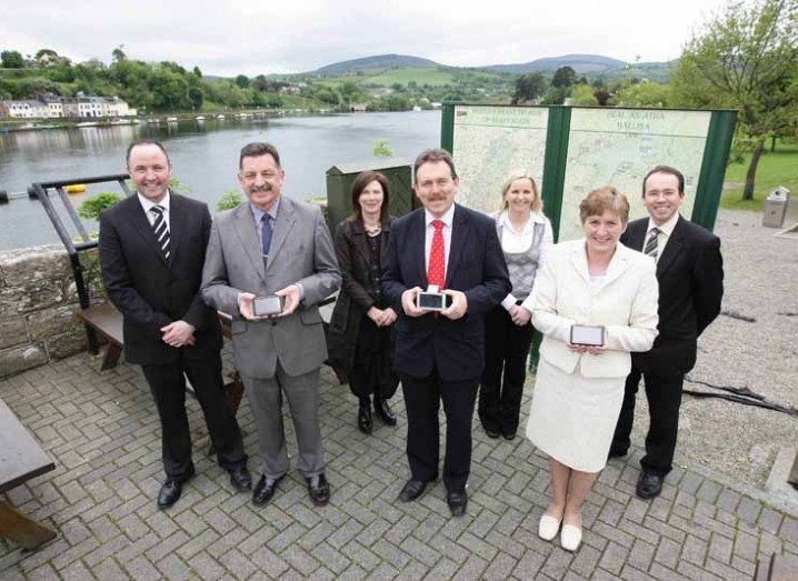
Pictured at the launch of a new project that makes 220 attractions in the North Tipperary area available on satnav systems were (from left): Adam Skerritt, Shannon Development; Terry O’Niadh, county manager, North Tipperary County Council; Attracta Lyons, North Tipperary County Council; John King, assistant chief executive, Shannon Development; Teresa Nash, Shannon Broadband Ltd; Alice Morgan, Shannon Development; and Ken Stockil, Shannon Broadband Ltd