Image: © sizsus/Stock.adobe.com
Using AI, organisations are trying to help bring more accurate climate modelling to data-scarce regions of the planet.
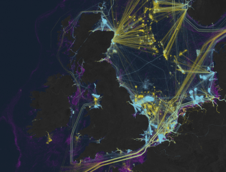
A collaboration has been announced by The Alan Turing Institute, with its Turing-Lloyd’s Register Foundation Data Centric Engineering Programme, and a UK earth science AI start-up called Cervest. The project is hoping to fill in maps across the world where climate data is scarce, which leaves organisations and communities reliant on fragmented data and high-level predictions on climate and extreme event exposure.
While initially designed for crop yield forecasting and remote sensing data, the ‘multi-resolution multi-task learning models’ are designed to create high resolution images of areas of land, by integrating information and evidence from multiple resolutions across space and through time.
With this information, the collaborators said, organisations and communities globally will be able to quantify climate impacts on national infrastructure decisions. Eventually, it’s hoped that the technology can be transferred to other asset categories to help measure the causes and impacts of climatic and extreme events.
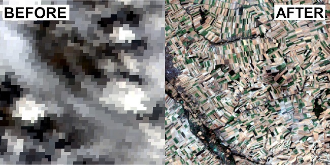
A low-resolution image of land with significant cloud cover versus a high-resolution prediction of the same area of land. The process can predict what is happening under the cloud cover with enough information. Image: The Alan Turing Institute/Cervest
Creating air pollution maps
Mark Girolami, director of The Alan Turing Institute-Lloyd’s Register Foundation Data Centric Engineering programme, said: “We can also use it to assist in drawing evidence-based conclusions where we have previously lacked data, for example with air pollution maps.
“Methodologies we are developing together will be able to be deployed on many other challenges as well, catalysing the engineering sciences with new methods and approaches.”
Cervest founder and CEO, Iggy Bassi, said the goal is to “empower everyone to make informed decisions that improve the long-term resilience ” of the planet.
“With The Alan Turing Institute, we want to use this new, cost-effective methodology and technology to help communities and organisations quickly understand more about their land-based assets and how it will change in the future to ensure informed and timely decisions.”
Satellite imagery is increasingly being used to monitor climatic events on Earth. Recently, a series of images taken by the European Space Agency’s (ESA) Copernicus Sentinel-2 satellite showed fire, smoke and the resulting destruction of wildfires near Chernobyl, highlighting how close the fires got to the site of the 1986 nuclear disaster.