Every day, we are greeted with new and wonderful maps. Maps of road networks, maps of coastlines, maps of races – maps, maps, maps. Well here are 10 wildly different maps that you really should see.
There seems to be something deeply satisfying about maps. They break society down to a structured plan.
Removing the heaving, bustling streets, negating the stress of time, boiling it all down to beautiful, right-angled pictures.
It’s almost like, deep down, many of us wish to live in a cartographer’s world.
So here are 10 completely different, utterly interesting maps we’ve found around the web. Some of the larger images can be clicked on to view in a larger format:
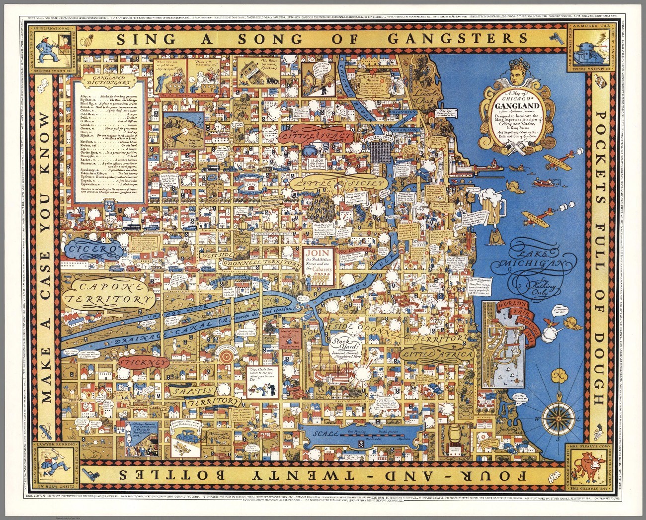
Chicago Ganglands, 1930s
This map is incredibly detailed, and perhaps needlessly so, too. There’s even a game to be played, but you will need to see the map in full resolution to do so. Here’s the large imgur file, with the game written around the edges of the map…
What if Pangea tickles your fancy?
Massimo Pietrobon created this masterpiece, a colourful and easy to read map of what the Pangea supercontinent would look like with today’s geographical terminology.

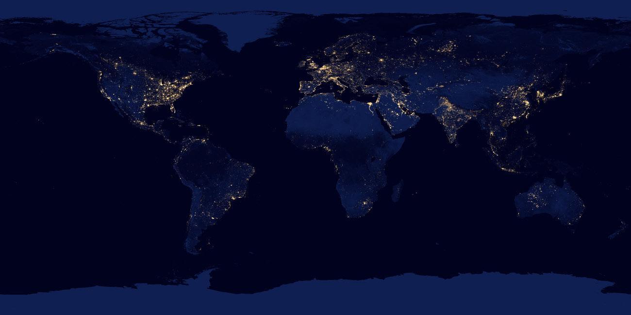
The Earth at night
Sometimes maps don’t need many ingredients. In this instance, NASA created this satellite-powered view of Earth, showing what each area looks like during the nighttime.
Copenhagen looks a bit bright.
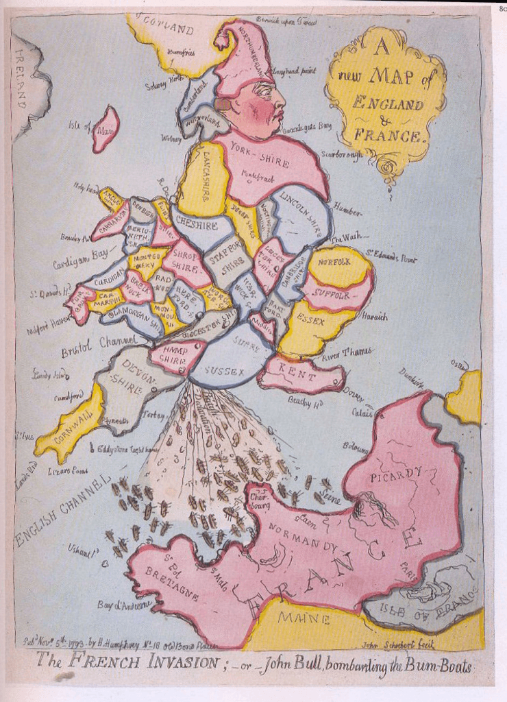
Ye olde map of England and France
Sometimes maps serve political purposes. Like when someone drew a map of England and France back in 1793. More specifically, England’s invasion of France back in 1793.
It’s hardly to scale, and mass erosion has removed most traces of a red-cheeked face from Yorkshire’s topography.
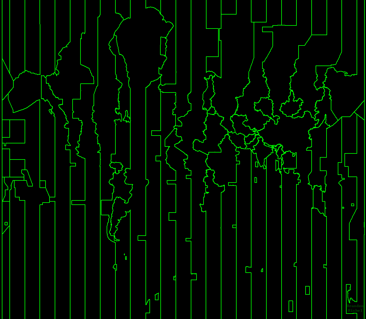
What time is it?
This map, we only discovered this morning and it’s brilliant. It may look like a rubbish poster for a movie you will never go see, but if you look a little closer you will notice it’s a map of Earth, taking into account just the time zone rules.
Take a bow Branden Rishel…
Transport, got to love transport
This map of London’s underground is actually interactive when you head here. Better still, it’s one of a series of transport maps.

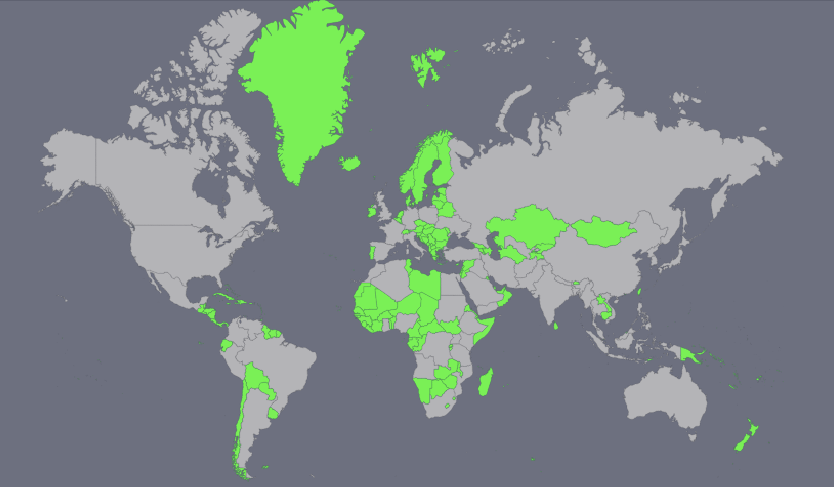
In a New York minute…
This map is a fair bit more simple. Highlighted in green is every country with a population below New York City’s metro area. The emerald isle is looking a bit… lime. Aamirislam posted this on Reddit.
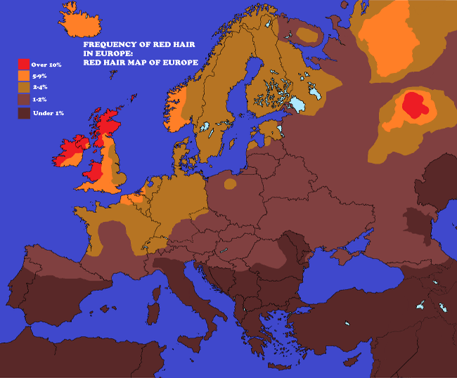
Seeing red
This map maps (sorry) different European countries’ prevalence for red hair. I genuinely never knew part of Russia would be prominent in this one…
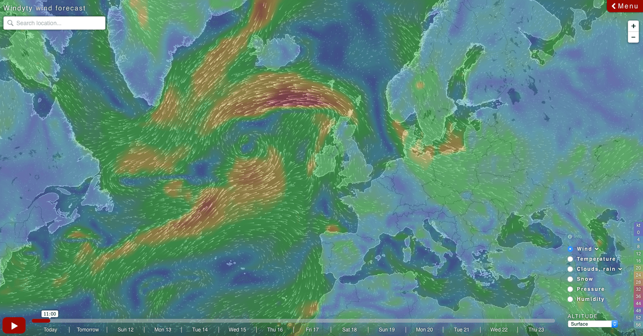
Always take the weather with you
Another interactive map on this list, WindyT’s cool environmental, live feed. You can choose between a number of weather measurements and scroll around – or zoom in on – the map of Earth.
Russia, 1903
This final map is a masterpiece. It’s a 1903 illustrated map of the European end of Russia, and it has immense detail. It’s in Russian, so perhaps the detail will be lost on some, but it’s clearly a work of art.
Via Brutalenko on Reddit.

Main image via Shutterstock