A lifelong love of geography led this lead GIS consultant to her current role at Esri Ireland where she brings maps to life using digital tools.
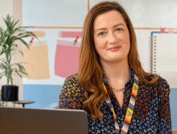
“Even though I was interested in a scientific career, I wanted to explore something beyond the typical science fields,” says Antonia Blankenberg. Today, Blankenberg is a lead consultant at Esri Ireland, a geographic information systems (GIS) provider.
She discovered she had a passion for GIS when she took a module on the subject as part of her undergraduate geography degree at Trinity College Dublin. She later did a master’s in Geographical Information Science at TU Dublin before getting a job at Esri and working her way up the ranks to become a senior GIS consultant. It’s fair to say that Blankenberg’s job is scientific, albeit not in the traditional sense. She works with data, visuals and tech tools to help Esri Ireland’s clients understand the world better through maps.
GIS’ real-world applications are limitless
When asked to explain GIS to a lay audience, she says that it is simply a case of blending regular data with geography. “Imagine GIS as a tool that paints a visual representation of the world on your computer screen. It’s like blending geography with regular computer data.”
“Through GIS, we analyse data to make it easily comprehensible. This can involve crafting printed maps or creating maps that are web-based and interactive. Other times, it involves building informative dashboards or conducting surveys to gather data out in the field.”
But Blankenburg adds that everyone might have a different way of explaining GIS based on how they use it. She believes that its real-world applications are “limitless”. It can be used for anything from city planning and optimising farming techniques to mapping emergencies like Covid-19 and travel systems, she says.
‘Through GIS, we analyse data to make it easily comprehensible’
Blankenberg has a keen interest in the visual side of GIS, with a background in cartography and visual design. She enjoys using these skills to create informative and interactive maps. Every year, she participates in Esri’s 30-Day Map Challenge, which involves making 30 themed maps in a month. It sounds hectic, but she relishes the challenge, adding that it enables her to connect with the wider GIS community and have fun making maps based on daily themes. A lot of her Esri Ireland colleagues join in and they all use different tools like images and code to create their maps.
A varied landscape
Talking of tools, technology is a pretty major asset to Blankenberg. While no two days are the same for her, she describes her regular duties as “tech leadership”.


“I’m involved in designing solutions, estimating project needs and identifying project requirements. I also help to guide projects from a technical standpoint. I’m responsible for ensuring that projects are kept on track and delivered to a high standard while providing support to colleagues.” She also spends time on DevOps to oversee other consultants’ work. What aspect of using tech for GIS does she find the most interesting?
‘What really excites me is focusing on UX. Initially, the focus was on obtaining and providing data. What’s incredible now is the shift toward a comprehensive UX, covering the entire journey of data’
Her appreciation for the visual side of digital maps means she is particularly interested in improving UX capabilities so the public can interact with the maps Esri Ireland produces. UX tech is one of the many fast-changing aspects of GIS, which Blankenberg says makes presenting data a lot easier.
“What really excites me is focusing on UX. Initially, the focus was on obtaining and providing data. What’s incredible now is the shift toward a comprehensive UX, covering the entire journey of data. We’re involved in the complete design of data presentation, crafting what looks like a full-fledged website for users.
“Esri Ireland also designs and publishes a range of StoryMaps highlighting different celebrations, historical events, or culturally significant dates across the country. These maps provide a more captivating way to visualise information, expanding beyond mere data management.”
There is another bonus to the advancements in UX. It has improved collaboration and information sharing, Blankenberg has found. “While the technology used to have more limitations a few years back, today everything is incredibly adaptable. We can fine-tune solutions to fit each customer’s exact requirements, creating a bespoke approach. This personalised touch translates to more effective results.”
As one would expect from a consultant, Blankenberg has to have very good interpersonal and problem-solving skills. She is not just a technologist, she is actively demonstrating GIS tools to Esri Ireland clients and the public. “Sometimes, figuring out exactly what a customer needs can be tricky. We often call this process ‘peeling the onion’ as it can be like solving a puzzle. The real challenge is identifying the root problem. But when you find the solution, it’s really satisfying. It’s great to see a project go live, watch customers use the solution and see them benefit from it. We’ve had customers tell us that problems that used to take days or weeks are now solved in minutes. Hearing success stories like this is truly gratifying and validates all the effort that goes into the work.”
10 things you need to know direct to your inbox every weekday. Sign up for the Daily Brief, Silicon Republic’s digest of essential sci-tech news.