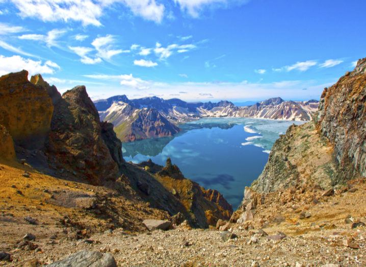
Mount Baekdu, a different mountain on the North Korean and Chinese border. Image: meteorite/Shutterstock
North Korea has called for denuclearisation of the Korean peninsula, but not before powerful satellites analysed the mountain destroyed by nuclear testing.
It seemed too good to be true for some political commentators, but North Korea appeared to do a complete 180 in recent months by opening dialogue with its southern neighbour and calling for an end to potential nuclear conflict on the continent.
Prior to these events, North Korea appeared to be bringing the world to the brink of war with the testing of its latest nuclear weapons and rocket systems, reportedly capable of reaching the mainland US.
The focal point of this testing was North Korea’s Punggye-ri test site located within Mount Mantap. On a number of occasions, this saw a surge in seismic activity and subsequent earthquakes caused by the powerful detonations.
Peering into a mountain
Now, thanks to powerful satellites in orbit, an international team of researchers has been able to peer inside the mountain to see just how much it has been altered by the largest of its nuclear tests on 3 September 2017.
Following the test, speculation grew as to what happened to the surrounding environment after the explosion, which is estimated to have had a yield close to 250 kilotons, or nearly 17 times more powerful than the bomb dropped on Hiroshima.
In a paper published to Science, the researchers collected seismic recordings from global and regional networks, and before-and-after radar measurements of the ground surface from Germany’s TerraSAR-X and Japan’s ALOS-2 radar imaging satellites, using radar imaging called SAR (synthetic aperture radar).
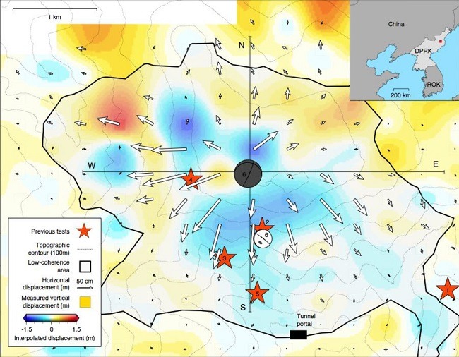
3D displacements derived from radar imagery with arrows indicating horizontal, colour indicating vertical motions spanning the explosion and about one week of additional deformation. Image: Earth Observatory of Singapore, Nanyang Technological University
Pinpoints exact spot
Through analysis, this showed that the underground blast pushed Mount Mantap outward by as much as 3.5 metres, and left the mountain half a metre shorter.
With some clever computer modelling, the team was able to pinpoint the exact spot where the explosion took place, at between 400 and 600 metres directly below the mountain’s peak.
The team was also able to pinpoint where the first aftershock occurred, 8.5 minutes after the initial explosion and 700 metres south of the blast.
Interestingly, this is about halfway between the site of the nuclear detonation and an access tunnel entrance. This suggests that the aftershock could have been caused by the collapse of part of the tunnel or of a cavity remaining from a previous nuclear explosion.
Our friends at @AirbusDefence shared radar images of North Korea's nuclear test site showing post-test subsidence.https://t.co/DtWBQY2jUN pic.twitter.com/jII5NNJzKs
— Jeffrey Lewis (@ArmsControlWonk) September 13, 2017
‘Spaceborne monitoring has been underexploited’
In terms of concluding an accurate yield of the device, the team seemed to confirm previous estimates with a new estimate of between 120 and 300 kilotons.
The new information suggested a scenario whereby the bomb vaporised granite rock in a cavity the size of a football stadium, raising the mountain two metres before it collapsed to form a depression within minutes, hours or days of the event.
There is even the suggestion that there might be continuing post-explosion compaction at the mountain.
“This study demonstrates the capability of spaceborne remote sensing to help characterise large underground nuclear tests, if any, in the future,” said Teng Wang from Nanyang Technological University in Singapore.
“While surveillance of clandestine nuclear tests relies on a global seismic network, the potential of spaceborne monitoring has been underexploited.”