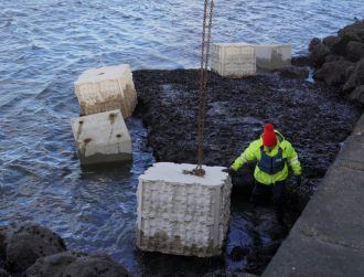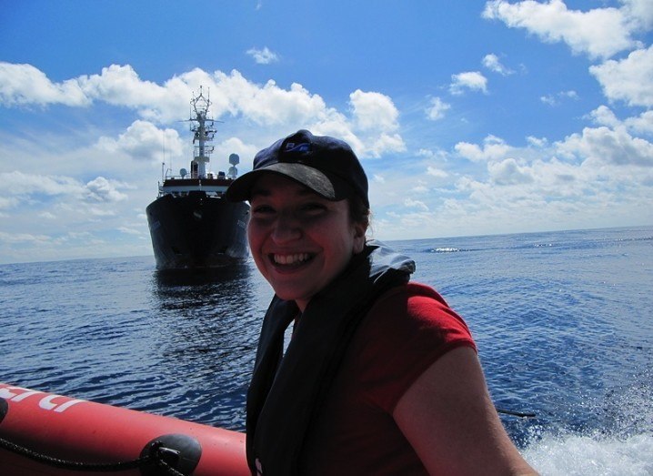
Dr Aggie Georgiopoulou in front of the German research vessel Poseidon in the Atlantic south of the Canary Islands
Dr Aggie Georgiopoulou is exploring the oceans and finding clues about the seabed’s dynamic past.
Despite the name, landslides can happen at sea. And when the seabed heaves and displaces, it can trigger tsunamis. But how can we find out which marine landslide hotspots are likely to cause trouble? Dr Aggie Georgiopoulou is getting to know the history, behaviours and ‘personalities’ of ancient marine landslides with a view to feeding into risk assessments.
“Landslides at sea can not only wipe out life in the local area on the seabed, they can also be a geohazard, and that is why we need to better understand them,” says Georgiopoulou, who is a lecturer in sedimentology at University College Dublin School of Geological Sciences. “For example, an earthquake can trigger a tsunami and a landslide, and then the landslide can go on to trigger a second tsunami, so we need to understand this to be able to issue warnings.”
Undersea landscape
We are getting a better appreciation of the seabed ‘landscape’ thanks to various developments in technology, according to Georgiopoulou, who welcomes the new perspectives on the ocean floor.
“Now we can visualise the seabed much better and we know it is not flat, it is a very dramatic landscape,” she says. “If you have very steep slopes underwater and now imagine you are piling on a lot of sediment on top of that, it can collapse — then depending on the types of sediments and what triggered that collapse, the landslide is either going to be small or large, it is going to more or less stay put or it will go really far.”
To build up a better picture of how and why such events happen, Georgiopoulou analyses sites of historic marine landslides. To date, her work has focused on hotspots such as the waters close to the Canary Islands, the Mediterranean and Rockall Trough off the north-west coast of Ireland.
“There is a landslide site [at Rockall], and we are trying to model it to understand if there were multiple events, and if so how frequent were they, and whether the volume of sediment would have the potential to cause a tsunami,” she explains.
Layers of clues
Georgiopoulou works with data collected using acoustic waves to map the seafloor, and with cores of material bored from the sites — the deeper the material, the earlier it was deposited there. The content and patterns of sediment layers in these cores provide clues about what happened and when.
“Normally sedimentation in the ocean is really slow, the dead shells and dead animals ‘rain’ out of seawater, this is called ‘marine snow’, they settle down, and we can estimate how long ago they did that,” she explains. “Then if you suddenly have a landslide, that is instantaneous and the material laid down will look different, it will have sedimentary structures, probably layering and internal structures of sediment waves from rippling.”
‘I felt like I was walking on the seafloor’
Georgiopoulou recently got a whole new perspective at Rockall on an expedition aboard the Celtic Explorer during which the remote-operated vehicle (ROV) Holland 1 visited the landslide site and collected samples.
“That was an amazing experience,” she recalls. “I am a marine geologist, and this was the first time I felt like I was walking on the seafloor. I could see the landslides that I have been working on for so many years, we could see the scars and the layers and I could instruct the vehicle to pick samples — I was so excited. You can’t dive down as a human to these depths of water, so for a long time we have been relying on echo-sound technology and sonars to give us an image of what is going on — with ROVs the game has completely changed.”
At home at sea
Expeditions at sea are one of Georgiopoulou’s favourite aspects of the work — she feels at home on the ocean wave. “I am a captain’s daughter,” says the Greek native. “My Dad was a captain on cargo ships and I never thought I would end up following in his footsteps, but I caught the bug as undergraduate — one of our lecturers was involved in a survey in the Ionian Sea ahead of laying new fibre optics, and we got the chance to spend time on the expedition. I loved it.”
Part of the fun is encountering whatever crops up — the weather, the wildlife, the technical malfunctions that need to be fixed on the spot — but ultimately Georgiopoulou relishes being an explorer.
“When I am at sea I am happy, I feel it is where I belong, and the ultimate joy is being a true explorer, which we are not able to do a lot of anymore,” she says. “I can be the first human to see something, I am able to bring it to you and show it to you and tell you about it, I thank my lucky stars that I can do that through my research.”
And in this week where we have just seen clear images from a flyby of Pluto, Georgiopoulou would also like to see more resources and curiosity ploughed into the marine environment on Earth. “We know more about space than we do about our ocean,” she says. “I fully support space exploration, but would like ocean exploration to be in parallel.”
Women Invent is Silicon Republic’s campaign to champion the role of women in science, technology, engineering and maths. It has been running since March 2013, and is kindly supported by Intel, Eircom, Fidelity Investments, ESB, Accenture and CoderDojo.