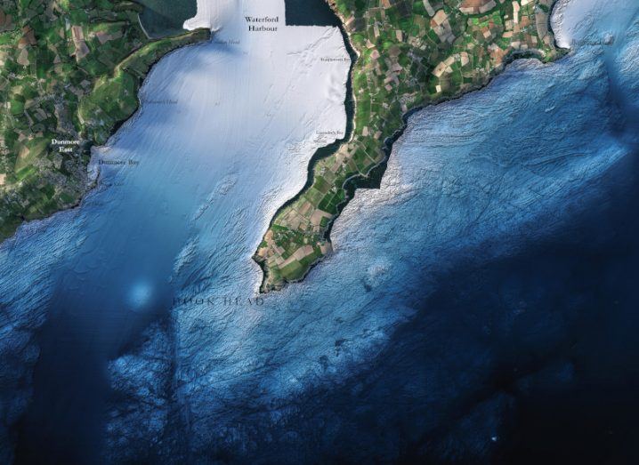
A map of Hook Head in Co Wexford from the INFOMAR project. Image: INFOMAR
Geologist and hydrographer Eoin Mac Craith explains his role on a seabed-mapping project and why it’s actually harder to map shallow water than deep.
Since 2006, the Integrated Mapping for the Sustainable Development of Ireland’s Marine Resource (INFOMAR) project has been mapping Ireland’s coastal seabed in comprehensive detail.
A joint venture from the Geological Survey of Ireland and the Marine Institute, the project is now in its final phase. Since August, the INFOMAR team have been releasing detailed maps of Ireland’s coastal seabed to highlight the project work.
Working on the project is a multidisciplinary team from a range of marine science fields. Eoin Mac Craith is a senior geologist and hydrographer who has worked on INFOMAR for more than 10 years.
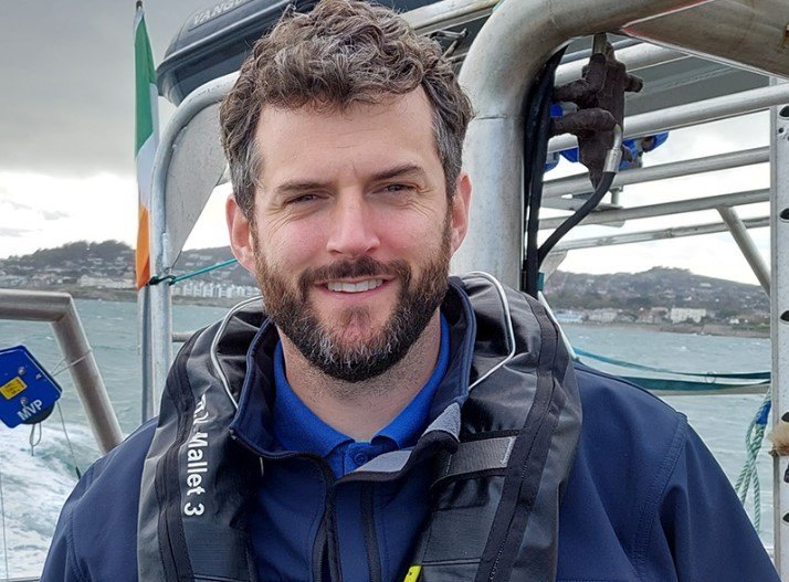
Image: Eoin Mac Craith
With a BSc in geology and an MSc in oceanography, Mac Craith initially worked with a seabed survey company in the UK. “They sent me on some very interesting and challenging fieldwork, from working as a metocean engineer in Kazakhstan and the Caspian Sea, to doing marine geophysics in the United Arab Emirates,” he says.
“I learned a lot about the industry and then returned home to Ireland to work for Geological Survey Ireland.”
Mac Craith regularly worked offshore on Ireland’s survey vessels before recently moving to a management role.
Tell us about your work.
I work primarily on the INFOMAR programme, which aims to map all of Ireland’s shelf and inshore seabed by 2026.
It has evolved as marine survey technology has developed, allowing us to get higher resolution imagery of the seabed with time.
My day to day from spring to autumn involves coordinating offshore operations for the inshore survey vessels – rostering personnel, survey planning, arranging logistics and reviewing daily reports on survey progress.
‘We need to make use of the sea to survive – for food, renewable energy and as a vital component of our climate – but we also need to do that responsibly’
There are daily challenges in terms of vessel and survey equipment repairs, assessing weather conditions and navigational hazards.
During the winter, the vessels remain in port and we get time to analyse the data and make it available to the public for free as a range of chart products.
In your opinion, why is your work important?
Mapping the seabed in great detail has never been more important, with the seas around Ireland becoming a busier space.
We need to make use of the sea to survive – for food, renewable energy and as a vital component of our climate – but we also need to do that responsibly. The only way to do that is with accurate seabed maps that tell us about the depth, sediment type and the distribution of sensitive habitats.
We have existing maps from the 19th century, but there is no comparison with the level of detail that can now be gained using modern acoustic technology. We regularly find navigational hazards that could not be detected by older technologies, and so safety of life at sea is one of INFOMAR’s most important applications.
What inspired you to work in this field?
When I was young, I used to look out to sea and wonder what the landscape was beneath the water – how deep it was, were there canyons and mountains and so on. I remember books in school with artist’s impressions of the ocean floor showing deep basins and dramatic underwater scenery and that captured my imagination.
What are some of the biggest challenges or misconceptions you face in this field of work?
One of the biggest challenges we face is the weather. Ireland has some of the strongest winds in the world off the west coast and this makes survey work very challenging.
One of the misconceptions we face in this field of work is that shallow water is quicker to survey than deep water. It’s actually the other way around. With shallow water, the sonar is closer to the seabed and so its footprint is smaller, much like bringing a torch light closer to a wall. This requires more passes by the vessel back and forth to fully survey a given area. This is why the Irish National Seabed Survey, which mapped water that was thousands of metres deep, only took six years while INFOMAR is a 20-year programme.
Do you think public engagement with science has changed in recent years?
There’s a lot more engagement and interest in the sciences these days, across a range of disciplines as developments in technology are progressing very rapidly. The world has never been more connected in terms of information sharing, but with that comes the risk of misinformation as well. The importance of verifying sources of scientific information has never been greater.
10 things you need to know direct to your inbox every weekday. Sign up for the Daily Brief, Silicon Republic’s digest of essential sci-tech news.