Game of Thrones is back on people’s screens, and minds, and to help you get a better grip of the rather layered world in which the Game of Thrones universe bases itself, here are five amazing maps to navigate five seasons of material.
If you’re a fan of Game of Thrones, it’s likely you’re reading this after you’ve watched the return of the sixth season, or as you hotly anticipate watching it tonight, with it promising more bloody battles, treachery and, probably, some seemingly random moments of nudity.
In the space of four years and five seasons – almost all of which has been based on the series of books written by George R R Martin – a considerable amount of backstory, or lore, has been created, thanks to the sheer number of characters that appear on screen, if only for an episode.
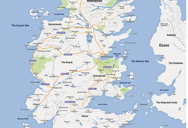
Of particular interest to amateur cartographers or those who just can’t get enough of maps and what they can reveal about a location – fictional or not – is the opening credits, which features an overlay of the Game of Thrones world, commonly referred to as the Known World.
Within this lies the three regions of Westeros, Essos, and Sothoryos, each of which is vastly different from the other and it has spurred on a number of programmers and cartographers to create some amazing visual representations of the world.
Here are five of the best of those creations, which have become visual wikis for die-hard fans, or just those who want to get a better idea of the world from above.
Quartermaester
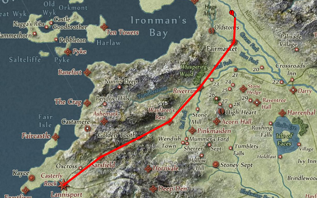
Starting strongly, we have arguably the most comprehensive of the maps, which has taken the Known World and turned it into a spoiler-free timeline of the entire show from beginning to end.
When you open the interactive map, you are presented with a detailed and appealing design that does more than just show you where the major areas are in the world, but also includes a detailed legend that allows you to click and follow the character arc of whoever has appeared in the show.
Once your character is selected, it’s then just a matter of sliding the rule at the top of the page to navigate to the episode you have last seen to see how far they’ve come in five years.
Being an interactive map, you can also zoom in to get a closer look at the routes and locations.
Hours could be spent with this.
HBO Viewer’s Guide
Not to be outdone by fans of the show, HBO itself has gone to the trouble of creating its own resource for fans, which includes a map to traverse.
With a minimalist style, the map features clickable locations that reveal the history behind them, from the wealthy port city of Qarth, to the harsh terrain of the Frostfang Mountains in the north.
Interestingly, however, the map designed by HBO clearly sticks with the TV shows canon, rather than delving into locations that would have made an appearance in the equally popular series of books that RR Martin continues to release, albeit at a slow pace.
Westeros, Google Maps style
It was always going to happen, wasn’t it? Given the obvious dominance of Google Maps as an online mapping tool, one Game of Thrones fan on Reddit – going under the name selvag – felt compelled to ditch the medieval-like stylings of other maps and go modern instead.
While only focusing on the region of Westeros, Selvag has stripped back much of the flair and drama behind regions on the fictional continent to leave just an easy-to-read guide of where the major locations are.
How do I get from King’s Landing to The Twins? Well, it’s made quite clear on this map, although it only begs the question of whether you could programme dragons to navigate using GPS, and save all the characters a lot of weary travelling.
Google Maps design of Westeros. Image via selvag/Reddit
Canon maps from the show
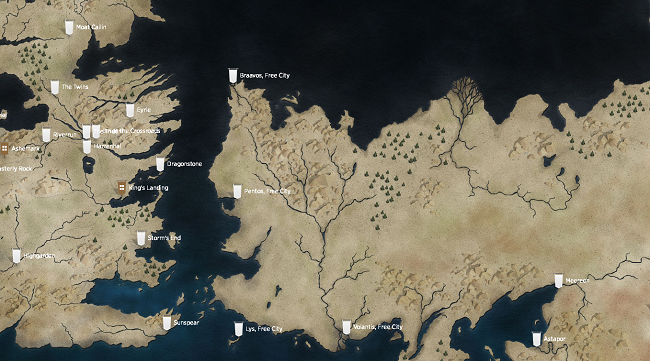
Sometimes maps aren’t just for navigation, but also just for decoration because, in many cases, they count just as much as pieces of art.
Step forward RR Martin, who is certainly fond of his map-making having submitted hand-drawn images of the Known World to his publisher, Random House, which are now available to buy as prints with the inclusion of a rather appealing colour palette.
The maps have been compiled into a book called Lands of Ice and Fire: Maps from King’s Landing to Across the Narrow Sea, revealing character arcs, but should be interesting for anyone who appreciates a good hand-drawn map that harks back to earlier times.
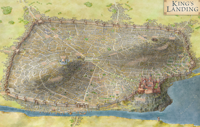
Sample map from Lands of Ice and Fire: Maps from King’s Landing to Across the Narrow Sea. Image via Becker & Meyer book producers
Game of Thrones Wiki
If sheer information overload is what you’re looking for, then the Game of Thrones Wiki is one rather large rabbit hole of information that in this case accompanies a map of the Known World.
By navigating the map you can find some of the names of locations, but digging a bit more into the wiki sees you come across information that ranges from lore from the fictional people who inhabit a region, to the climate and seasons of the very different regions of the mysterious world.
In this case, being told to ‘get lost’ is an encouragement to find out more than you thought you ever could about the series.
Menacing row of trees image via Shutterstock