West Thurrock model with geology and topography, as recreated by the British Geological Survey in Minecraft
Hey, this could catch on! The British Geological Survey is switching kids on to natural topography and geological databases by recreating entire towns like West Thurrock, York and Ingleborough through the medium of Minecraft.
Minecraft is being used by the British Geological Survey to render beautiful rural landscapes that children can explore on their tablet, smartphone, PC or Xbox.
In what should spark the attention of the good folks at the Ordnance Survey of Ireland and mapping groups in countries worldwide, a whole new level of collaboration could begin that could enrich communities and merge wonderfully with kids’ learning of technology.
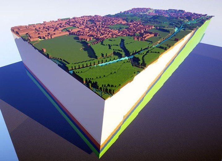
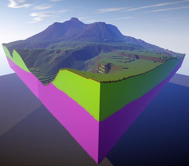
The British Geological Survey has so far created 3D representations of geology at several locations across the UK.
These models show how geology rises and falls and overlaps and folds at different depths.
Ingleborough model with geology and topography
“When building the map of Great Britain we used blocks which best resembled the ‘real’ geology, based on colour, texture and hardness,” the British Geological Survey said in a briefing note. “For the three-dimensional models we decided to use glass blocks that were coloured by their traditional geology map colours.”
To explore these three wonderful renderings – which I am certain could be the start of a major new trend – you need a Minecraft license and at least 50MB free disk space for each model and more than 4GB of RAM.
Enjoy!
York model with geology and topography
Gigglebit is Siliconrepublic’s daily dose of the funny and fantastic in science and tech, to help start your day on a lighter note – because sometimes the lighter side of STEM should be taken seriously, too.