Child playing Minecraft. Image: omihay/Shutterstock
Offering a whole new realm to play in, Ordnance Survey Ireland has made all of the country’s geospatial data available in the incredibly popular sandbox game, Minecraft.
With hundreds of thousands of players playing at any given time across the world, Minecraft is easily considered one of the biggest gaming franchises on the market today.
But unlike games like Call of Duty that encourage players to destroy as much as possible, Minecraft offers an unlimited sandbox arena where you can build your own world. All you need is an unlimited imagination.

The game is particularly popular among kids and teenagers and has now developed into a cult phenomenon with celebrity players. It has also been heralded by educators as a powerful tool for the next generation of designers and makers.
Anyone out there who might fancy building a whole new castle on the peak of Carrauntoohil now can do so, following a recent announcement by Ordnance Survey Ireland (OSI) that it has made all its available geospatial data for Ireland compatible with Minecraft.
This means that locations across the country can be recreated by any player of the game, simply by downloading the data from the OSI website.
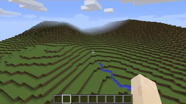
Carrauntoohil in Minecraft. Image: OSI
As large as Ireland itself
Amazingly, the data in the game has been represented on a scale of 1:1, which means that it would take as long to walk from end of the island to the other in the game, just as it would in real life.
According to the OSI, the data was extracted from the organisation’s spatial data storage platform Prime2 and then converted into a downloadable format in collaboration with CoderDojo.
“Users can now explore Dublin city centre and Limerick city in Minecraft,” the OSI said in a blog post. “They can visit the lakes of Killarney or climb Carrauntoohil and the Sugar Loaf.”
The first real use of geospatial data in the game came in 2013, when an intern working with the Ordnance Survey of Great Britain (OSGB) began releasing its data online. It showed accurate representations of everything from road networks to forests, at a scale of one block equalling 25 sq m.
The OSI cited the phenomenal success of Pokémon Go as an example of future crowdsourced geospatial data.
“[Pokémon Go] shows us that games have enormous potential beyond just being a means of entertainment, because they can be leveraged for geospatial data collection.
“Using a data set like this shows that geographical data has enormous potential to further enrich the future of gaming.”
Child playing Minecraft. Image: omihay/Shutterstock