Image: Vadim Sadovski/Shutterstock
A new look at dune compositions on Mars points to a watery history, with Namibian examples being examined by Trinity scientists.
The dunes of our deserts have provided a team of researchers with a terrestrial example of how extraterrestrial surfaces were formed, with the Namib Desert proving particularly interesting of late.
In a bid to establish the best place to investigate for water on Mars, Trinity College Dublin’s Dr Mary Bourke and University of Oxford’s Prof Heather Viles took to Namibia to investigate how long-gone water leaves visible clues on the surface.
Having previously found patterns called ‘arcuate striations’ between Namibian dunes, tangible investigation showed that they originated from dune sediments that had been geochemically cemented by salts left behind by evaporating groundwater.
These dune sediments later become relatively immobile, which means they are left behind as the dunes continue to migrate downwind. This, according to the duo, has visibly happened on Mars, too.
“On Earth, desert dune fields are periodically flooded by water in areas of fluctuating groundwater, and where lakes, rivers and coasts are found in proximity. These periodic floods leave tell-tale patterns behind them,” said Bourke.
“You can imagine our excitement when we scanned satellite images of an area on Mars and saw this same patterned calling card, suggesting that water had been present in the relatively recent past.”
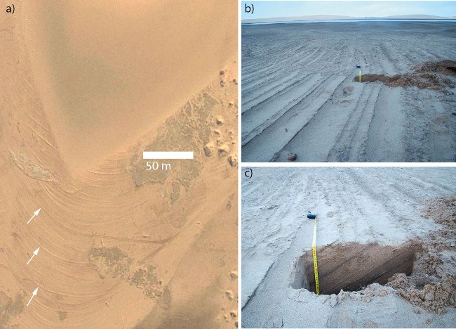
(a) Cross-beds upwind of the windward slope in Namibia, with white arrows highlighting particularly prominent examples. (b) Cross-beds showing general relief of interdune (less than 10cm). (c) Wall of pit excavated in (b) shows dipping sediment layers in subsurface are contiguous with protruding layers on the surface. Image: Mary Bourke
The study, published in American Geophysical Union’s Geophysical Research Letters, hypothesises that on Mars, the evidence is there for fluctuating levels of salty groundwater, during a time when dunes were actively migrating down the valley.
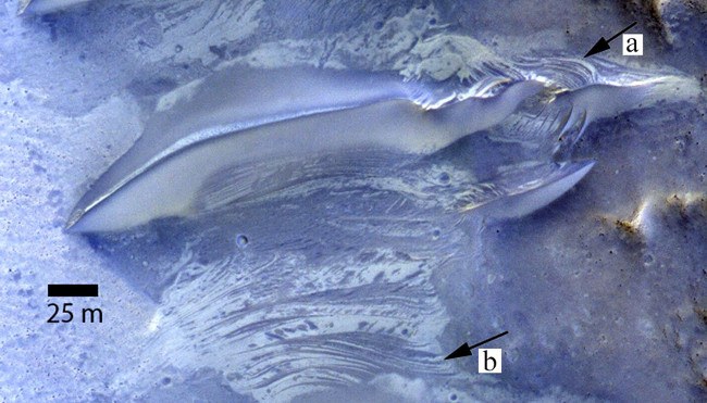
(a) Exposure of cross-beds on windward slope of dunes on Mars. (b) Interdune strata exposed in planform showing contrasting albedo and cross-cutting relationships similar to that exposed in the dune. Image: Mary Bourke
In 2015, Bourke was part of a trio of researchers that, for the first time, mapped the winds and sand dune evolution on the Red Planet.
Publishing their findings in Nature Communications, the trio created the model with help from image data courtesy of the HiRISE camera on the Mars Reconnaissance Orbiter. They then compared patterns with wind models that were tested on dunes seen on Northern Ireland’s peninsula of Magilligan.
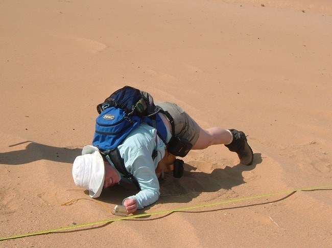
Prof Bourke examining ripples in the Namib Desert. Image: H Viles
They worked with data specifically from the Proctor Crater region on the southern highlands of Mars, discovering that ripples on the dunes moved around 1.5 metres per year.
“These findings are hugely significant,” said Bourke.
“Firstly, the Martian sand dunes show evidence that water may have been active near Mars’ equator – potentially in the not-too-distant past.
“And secondly, this location is now a potential geological target for detecting past life forms on the Red Planet, which is important to those involved in selecting sites for future missions.”