Drone in search-and-rescue operation in Ecuador following an earthquake in 2016. Image: Fotos593/Shutterstock
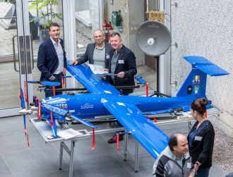
An Irish start-up developing software for emergency services drones has been named the first client of the Cork-based ESA incubator.
Last September marked a major milestone in the development of the Irish spacetech sector, after the European Space Agency (ESA) revealed that Tyndall National Institute in Cork was to be the site of its latest incubator.
The aim of the ESA Business Incubation Centre (ESA BIC) – of which there are 16 in Europe – is to support up to 30 Irish start-ups developing the latest in space technology for use on Earth.
The centre – part of the Space Solutions Centre hub – has now announced its first client, a start-up that develops software for emergency response teams involved in search-and-rescue operations.
Based in Dublin, DroneSAR’s software enables autonomous search flight patterns for drones and can live-stream high-resolution images and video back to incident control.
The location of the person or persons in distress can also be identified with GPS coordinates, shared instantaneously with search-and-rescue teams on the ground via SMS or email.
By becoming a client of the ESA BIC, DroneSAR will gain access to €50,000 in funding and support over the next two years from a number of Irish academic centres and Enterprise Ireland.
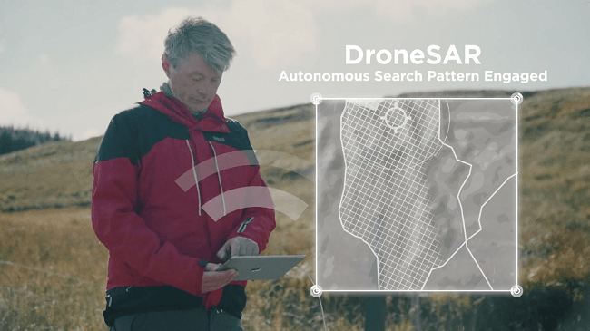
An example of DroneSAR’s capabilities. Image: DroneSAR
Will give start-up a ‘lift-off’
Space Solutions Centre manager David Gibbons said: “DroneSAR is using space technology and data to save lives.
“The ESA BIC programme will provide the ‘lift-off’ for DroneSAR to become a major player in search-and-rescue operations throughout the world.”
The company has already found success following a partnership with one of the world’s largest drone manufacturers, DJI, which is now using DroneSAR’s technology in its aircraft.
“This app is helping rescue teams with aerial live video streams and important information,” said DJI’s director of education, Romeo Durscher.
“The next step will be integrating satellite data through the ESA to share drone location data and images with first responders and their command centres, often many kilometres away.”
The market for emergency services drones is likely to expand, with DJI today (25 May) announcing the release of a new mini drone capable of being controlled by a person’s hand movements.
Drone in search-and-rescue operation. Image: Fotos593/Shutterstock