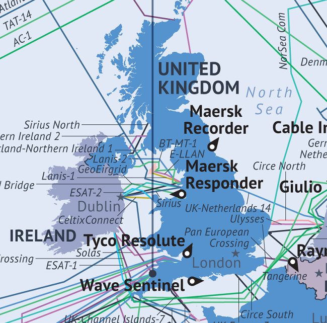
In its updated interactive map, TeleGeography has released a map charting every undersea cable that criss-crosses our planet keeping us all inter-connected through broadband.
There are currently over 300 high-speed fibre-optic cables linking all the continents in the world and amazingly, there are less than a dozen companies in the world who are responsible for the up-keep and p-lacing of these cables, essentially holding the fate of the internet in their hands.
Before a cable is laid, extensive surveys of the projected route are undertaken before an inch of cable is placed. Factors taken into consideration are the terrain of the sea-floor and other potential hazards like crevices or volcanic activity.
The map itself has a striking similarity to the world’s shipping routes creating images of older times which TeleGeography used as inspiration for its map last year.

Submarine cables across Ireland and the UK
A feat of engineering
When the route is decided, the construction company will bury the first segment of cabling until it reaches about 1.5km off the shore before it enters the more stable open ocean.
The cable that traverses the Izu-Ogasawara Trench off the coast of Japan is one of the deepest cable system in the world coming in at 8,000m, almost the same height as Mount Everest.
Of course, managing such enormous feats of engineering is incredibly difficult and faults can occur on a regular basis with 90pc of all faults attributed to environmental factors or human activity.
Despite this, all of the fibre-optic cables are heavily protected from most threats as it is covered in layers of galvanised armour wire, tar-soaked nylon, plastic and copper to insulate the cabling inside.

How a submarine cable is layered
One major omission from the map is the Asia Africa Europe-1 (AAE-1) cable that is expected to create a submarine fibre-optic link between the three continents in 2016.
The full interactive map is available on their website.